
Haz una donación
Mapa topográfico Lake D
Haga clic en el mapa para ver la altitud.
Haz una donación
Acerca de este mapa
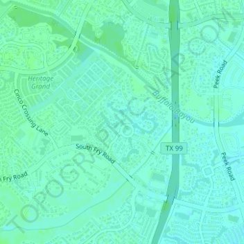
Nombre: Mapa topográfico Lake D, altitud, relieve.
Altitud media: 35 m
Altitud mínima: 31 m
Altitud máxima: 38 m
Haz una donación
Otros mapas topográficos
Haga clic en un mapa para ver su topografía, su altitud y su relieve.
Sugar Land
United States > Texas > Fort Bend County
Sugar Land is located in northeast Fort Bend County, 20 miles (32 km) southwest of downtown Houston. It is bordered by Houston to the northeast, and by Stafford, Missouri City, and Meadows Place to the east. According to the United States Census Bureau, the city of Sugar Land has a total area of 34.0 square…
Altitud media: 24 m
Haz una donación
Haz una donación
Haz una donación
Haz una donación
Sugar Land
United States > Texas > Fort Bend County
Sugar Land is located in northeast Fort Bend County, 20 miles (32 km) southwest of downtown Houston. It is bordered by Houston to the northeast, and by Stafford, Missouri City, and Meadows Place to the east. According to the United States Census Bureau, the city of Sugar Land has a total area of 42.9 square…
Altitud media: 24 m
Haz una donación
Haz una donación
Haz una donación