
Mapa topográfico Rufford CP
Mapa interactivo
Haga clic en el mapa para ver la altitud.
Acerca de este mapa
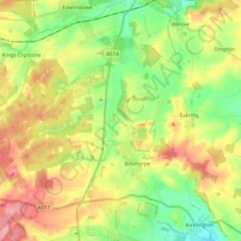
Nombre: Mapa topográfico Rufford CP, altitud, relieve.
Altitud media: 76 m
Altitud mínima: 29 m
Altitud máxima: 134 m
Otros mapas topográficos
Haga clic en un mapa para ver su topografía, su altitud y su relieve.
Sherwood Forest NNR
United Kingdom > England > Nottinghamshire > Newark and Sherwood > Ollerton > Edwinstowe CP
Sherwood Forest NNR, Broad Drive, Edwinstowe CP, Ollerton, Newark and Sherwood, Nottinghamshire, England, NG21 9HN, United Kingdom
Altitud media: 71 m