
Mapa topográfico Tanah Grogot
Mapa interactivo
Haga clic en el mapa para ver la altitud.
Acerca de este mapa
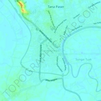
Nombre: Mapa topográfico Tanah Grogot, altitud, relieve.
Lugar: Tanah Grogot, Paser, East Kalimantan, 76521, Indonesia (-1.93492 116.17507 -1.89492 116.21507)
Altitud media: 5 m
Altitud mínima: 1 m
Altitud máxima: 25 m
Otros mapas topográficos
Haga clic en un mapa para ver su topografía, su altitud y su relieve.
Tajur
Indonesia > East Kalimantan > Paser
Tajur, Paser, East Kalimantan, Kalimantan, Indonesia
Altitud media: 13 m
Krayan Jaya
Indonesia > East Kalimantan > Paser
Krayan Jaya, Paser, East Kalimantan, Indonesia
Altitud media: 18 m