
Haz una donación
Mapa topográfico Belton
Haga clic en el mapa para ver la altitud.
Haz una donación
Belton
Belton is located 60 miles (97 km) north of Austin, 137 miles (220 km) south of Dallas, and 184 miles (296 km) west of Houston. It is near the center of Bell County at 31°3′32″N 97°27′48″W / 31.05889°N 97.46333°W / 31.05889; -97.46333 (31.058904, -97.463382). It is at the point where the Blackland Prairie, characterized by level ground and deep fertile soil, and the Edwards Plateau, characterized by its many springs, hills, and steep canyons, meet. Its elevation is approximately 509 feet (155 m).
Haz una donación
Acerca de este mapa
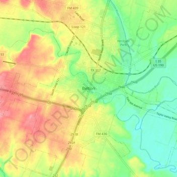
Nombre: Mapa topográfico Belton, altitud, relieve.
Lugar: Belton, Bell County, Texas, 76513, United States (31.01601 -97.50445 31.09601 -97.42445)
Altitud media: 176 m
Altitud mínima: 134 m
Altitud máxima: 223 m
Haz una donación