
Mapa topográfico Bristow
Mapa interactivo
Haga clic en el mapa para ver la altitud.
Acerca de este mapa
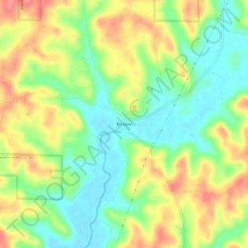
Nombre: Mapa topográfico Bristow, altitud, relieve.
Lugar: Bristow, Perry County, Indiana, United States (38.12006 -86.74166 38.16006 -86.70166)
Altitud media: 157 m
Altitud mínima: 122 m
Altitud máxima: 199 m
Otros mapas topográficos
Haga clic en un mapa para ver su topografía, su altitud y su relieve.
Fosters Ridge
United States > Indiana > Perry County
Fosters Ridge, Perry County, Indiana, 47515, United States
Altitud media: 196 m