
Gracias por apoyar a este sitio ❤️
Haz una donación
Haz una donación
Mapa topográfico Hochplatte
Haga clic en el mapa para ver la altitud.
Gracias por apoyar a este sitio ❤️
Haz una donación
Haz una donación
Acerca de este mapa
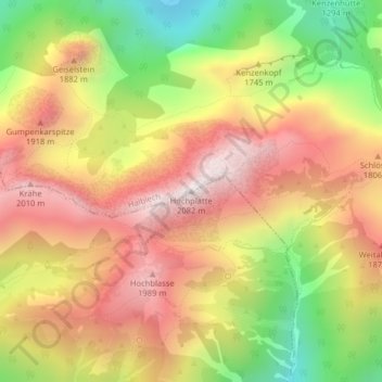
Nombre: Mapa topográfico Hochplatte, altitud, relieve.
Lugar: Hochplatte, Halblech, Landkreis Ostallgäu, Bayern, Deutschland (47.55222 10.84200 47.55232 10.84210)
Altitud media: 1,646 m
Altitud mínima: 1,151 m
Altitud máxima: 2,053 m
Gracias por apoyar a este sitio ❤️
Haz una donación
Haz una donación