
Mapa topográfico Dryden Farm
Mapa interactivo
Haga clic en el mapa para ver la altitud.
Acerca de este mapa
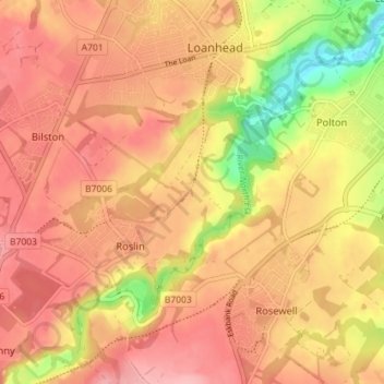
Nombre: Mapa topográfico Dryden Farm, altitud, relieve.
Altitud media: 144 m
Altitud mínima: 63 m
Altitud máxima: 187 m
Otros mapas topográficos
Haga clic en un mapa para ver su topografía, su altitud y su relieve.
Straiton Pond Local Nature Reserve
United Kingdom > Scotland > Midlothian > Loanhead
Straiton Pond Local Nature Reserve, Straiton, Loanhead, Midlothian, Scotland, United Kingdom
Altitud media: 131 m