
Mapa topográfico Punggol Dam
Mapa interactivo
Haga clic en el mapa para ver la altitud.
Acerca de este mapa
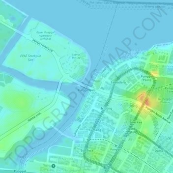
Nombre: Mapa topográfico Punggol Dam, altitud, relieve.
Lugar: Punggol Dam, Punggol, Northeast, Singapore (1.41405 103.89629 1.41527 103.89801)
Altitud media: 8 m
Altitud mínima: -4 m
Altitud máxima: 43 m
Otros mapas topográficos
Haga clic en un mapa para ver su topografía, su altitud y su relieve.
Pasir Ris Park
Singapore > Northeast > Singapore
Pasir Ris Park, Pasir Ris, Singapore, Northeast, Singapore
Altitud media: 7 m
Sea-Shell Park
Sea-Shell Park, Pasir Ris, Northeast, Singapore
Altitud media: 15 m