
Mapa topográfico Lac Michel
Mapa interactivo
Haga clic en el mapa para ver la altitud.
Acerca de este mapa
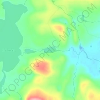
Nombre: Mapa topográfico Lac Michel, altitud, relieve.
Altitud media: 364 m
Altitud mínima: 321 m
Altitud máxima: 448 m
Otros mapas topográficos
Haga clic en un mapa para ver su topografía, su altitud y su relieve.
Lac Doolittle
Canada > Québec > La Vallée-de-la-Gatineau > Lac-Pythonga
Lac Doolittle, Lac-Pythonga, La Vallée-de-la-Gatineau, Outaouais, Québec, Canada
Altitud media: 379 m
Lac Rhéaume
Canada > Québec > La Vallée-de-la-Gatineau > Lac-Pythonga
Lac Rhéaume, Lac-Pythonga, La Vallée-de-la-Gatineau, Outaouais, Québec, Canada
Altitud media: 296 m
Lac Jean Pere
Canada > Québec > La Vallée-de-la-Gatineau > Lac-Pythonga
Lac Jean Pere, Lac-Pythonga, La Vallée-de-la-Gatineau, Outaouais, Québec, Canada
Altitud media: 386 m
Lac Camatose
Canada > Québec > La Vallée-de-la-Gatineau > Lac-Pythonga
Lac Camatose, Lac-Pythonga, La Vallée-de-la-Gatineau, Outaouais, Québec, Canada
Altitud media: 365 m
Ruisseau Antostagan
Canada > Québec > La Vallée-de-la-Gatineau > Lac-Pythonga
Ruisseau Antostagan, Lac-Pythonga, La Vallée-de-la-Gatineau, Outaouais, Québec, Canada
Altitud media: 395 m
Lac Camatose
Canada > Québec > La Vallée-de-la-Gatineau > Lac-Pythonga
Lac Camatose, Lac-Pythonga, La Vallée-de-la-Gatineau, Outaouais, Québec, Canada
Altitud media: 362 m