
Mapa topográfico Seyboldsdorf
Mapa interactivo
Haga clic en el mapa para ver la altitud.
Acerca de este mapa
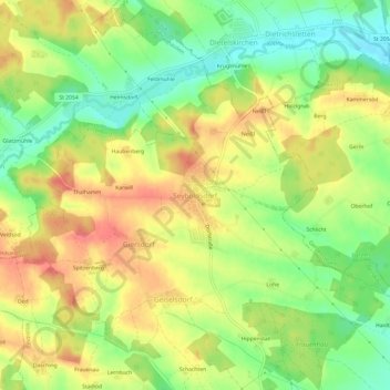
Nombre: Mapa topográfico Seyboldsdorf, altitud, relieve.
Altitud media: 470 m
Altitud mínima: 435 m
Altitud máxima: 504 m
Seyboldsdorf ist ein nördlich gelegener Gemeindeteil der Stadt Vilsbiburg im niederbayerischen Landkreis Landshut. Seyboldsdorf liegt auf einem Höhenrücken im Isar-Inn-Hügelland zwischen Großer und Kleiner Vils.